Share Does the flood levy banks on the Qeen Charlotte Creek impact on Hawthornden creeks ability to drain naturally or Does it create a Dam effect that will impact properties that were not considered to be in the flood plan area until the levy were constructed. on Facebook
Share Does the flood levy banks on the Qeen Charlotte Creek impact on Hawthornden creeks ability to drain naturally or Does it create a Dam effect that will impact properties that were not considered to be in the flood plan area until the levy were constructed. on X (formerly Twitter)
Share Does the flood levy banks on the Qeen Charlotte Creek impact on Hawthornden creeks ability to drain naturally or Does it create a Dam effect that will impact properties that were not considered to be in the flood plan area until the levy were constructed. on Linkedin
Email Does the flood levy banks on the Qeen Charlotte Creek impact on Hawthornden creeks ability to drain naturally or Does it create a Dam effect that will impact properties that were not considered to be in the flood plan area until the levy were constructed. link
Does the flood levy banks on the Qeen Charlotte Creek impact on Hawthornden creeks ability to drain naturally or Does it create a Dam effect that will impact properties that were not considered to be in the flood plan area until the levy were constructed.
JPS
asked
3 months ago
No. The Carlingford Street Levee is approximately 250m down stream of the confluence of Hawthornden Creek and Queen Charlottle Vale (QVC) Creek and does not impact the ability of Hawthornden Creek to drain into QCV creek, as reflected in the flood depth and water level contours in this area.
The flooding from Hawthornden Creek is largely driven by creek flows escaping the primary channel in certain locations and that water then flowing overland via alternate flow paths until either re-entering Hawthornden Creek or QCV creek downstream.
Some water is observed building up behind the Carlingford Street Levee (town side) in flood events, with some of this water from some of the overland flow paths from Hawthornden Creek, but it is important to note that there is infrastructure in place to help manage these flows and the flooding this causes behind the levee, is less than the flooding which would be seen in this area if the levee was not in place.
Share What compensations will be provided to residents who are now rezoned.
on Facebook
Share What compensations will be provided to residents who are now rezoned.
on X (formerly Twitter)
Share What compensations will be provided to residents who are now rezoned.
on Linkedin
Email What compensations will be provided to residents who are now rezoned.
link
What compensations will be provided to residents who are now rezoned.
Shell
asked
3 months ago
No land use rezoning is proposed to occur under the scope of the draft flood study currently on exhibition. Rather the draft Flood Study will identify those properties that will be located within the new Flood Planning Area. Future amendments to the Bathurst Regional Development Control Plan 2014 will determine what development controls should apply to lands within the new Flood Planning Area. With regard to the proposed change to the flood planning area which increases the number of properties identified, Council is not liable for the financial implications that may result for individual property owners.
Council has a responsibility to quantify the risk and potential extent of the impact of flooding to ensure that Council’s response to flood risk management is appropriate and effective. The draft Flood Study Update defines this risk with a Flood Risk Management Study proposed to commence following the finalisation and adoption of the Flood Study Update, to allow Council to update current flood management practices in line with the best information available.
Share I am very concerned if the proposal goes ahead, will our properties which are currently Flood Protected, will they still remain Flood Protected? Nursing Home. Day Care Centre. Oak Tree Retirement Village etc etc in Stanley Street. The businesses here cannot operate without insurance. If this Flood Protected area becomes a flood area, there will be thousands of people here who could become victims.
Without insurance, no one could live or work here. Businesses can’t operate without insurance. We couldn’t resell.
If the businesses or homeowners were able to get Flood Insurance, the premiums would be catastrophic, as well as contents insurance, car insurance, and resales would be non existent.
There are many businesses along Stanley Street, as well as Carlingford Street. And thousands of people along Stanley Street, Morrisette Street, bottom of Peel and Hope Street, as well as businesses and homes in Carlingford Street.
People and Property must come first.
Surely Bathurst Regional Council would raise the levy banks higher, to protect these people and property. That is the only solution if this flood proposal goes forward.
Raise the levy banks higher.
I’ve spoken to a council worker who originally built the levy banks. He said it is easy to do, cost efficient, and council could also obtain grant funding for this to be done.
Will Council make this the number one priority instead of adjusting the zoning? We must remain a Flood Protected area.
Thankyou. on Facebook
Share I am very concerned if the proposal goes ahead, will our properties which are currently Flood Protected, will they still remain Flood Protected? Nursing Home. Day Care Centre. Oak Tree Retirement Village etc etc in Stanley Street. The businesses here cannot operate without insurance. If this Flood Protected area becomes a flood area, there will be thousands of people here who could become victims.
Without insurance, no one could live or work here. Businesses can’t operate without insurance. We couldn’t resell.
If the businesses or homeowners were able to get Flood Insurance, the premiums would be catastrophic, as well as contents insurance, car insurance, and resales would be non existent.
There are many businesses along Stanley Street, as well as Carlingford Street. And thousands of people along Stanley Street, Morrisette Street, bottom of Peel and Hope Street, as well as businesses and homes in Carlingford Street.
People and Property must come first.
Surely Bathurst Regional Council would raise the levy banks higher, to protect these people and property. That is the only solution if this flood proposal goes forward.
Raise the levy banks higher.
I’ve spoken to a council worker who originally built the levy banks. He said it is easy to do, cost efficient, and council could also obtain grant funding for this to be done.
Will Council make this the number one priority instead of adjusting the zoning? We must remain a Flood Protected area.
Thankyou. on X (formerly Twitter)
Share I am very concerned if the proposal goes ahead, will our properties which are currently Flood Protected, will they still remain Flood Protected? Nursing Home. Day Care Centre. Oak Tree Retirement Village etc etc in Stanley Street. The businesses here cannot operate without insurance. If this Flood Protected area becomes a flood area, there will be thousands of people here who could become victims.
Without insurance, no one could live or work here. Businesses can’t operate without insurance. We couldn’t resell.
If the businesses or homeowners were able to get Flood Insurance, the premiums would be catastrophic, as well as contents insurance, car insurance, and resales would be non existent.
There are many businesses along Stanley Street, as well as Carlingford Street. And thousands of people along Stanley Street, Morrisette Street, bottom of Peel and Hope Street, as well as businesses and homes in Carlingford Street.
People and Property must come first.
Surely Bathurst Regional Council would raise the levy banks higher, to protect these people and property. That is the only solution if this flood proposal goes forward.
Raise the levy banks higher.
I’ve spoken to a council worker who originally built the levy banks. He said it is easy to do, cost efficient, and council could also obtain grant funding for this to be done.
Will Council make this the number one priority instead of adjusting the zoning? We must remain a Flood Protected area.
Thankyou. on Linkedin
Email I am very concerned if the proposal goes ahead, will our properties which are currently Flood Protected, will they still remain Flood Protected? Nursing Home. Day Care Centre. Oak Tree Retirement Village etc etc in Stanley Street. The businesses here cannot operate without insurance. If this Flood Protected area becomes a flood area, there will be thousands of people here who could become victims.
Without insurance, no one could live or work here. Businesses can’t operate without insurance. We couldn’t resell.
If the businesses or homeowners were able to get Flood Insurance, the premiums would be catastrophic, as well as contents insurance, car insurance, and resales would be non existent.
There are many businesses along Stanley Street, as well as Carlingford Street. And thousands of people along Stanley Street, Morrisette Street, bottom of Peel and Hope Street, as well as businesses and homes in Carlingford Street.
People and Property must come first.
Surely Bathurst Regional Council would raise the levy banks higher, to protect these people and property. That is the only solution if this flood proposal goes forward.
Raise the levy banks higher.
I’ve spoken to a council worker who originally built the levy banks. He said it is easy to do, cost efficient, and council could also obtain grant funding for this to be done.
Will Council make this the number one priority instead of adjusting the zoning? We must remain a Flood Protected area.
Thankyou. link
I am very concerned if the proposal goes ahead, will our properties which are currently Flood Protected, will they still remain Flood Protected? Nursing Home. Day Care Centre. Oak Tree Retirement Village etc etc in Stanley Street. The businesses here cannot operate without insurance. If this Flood Protected area becomes a flood area, there will be thousands of people here who could become victims.
Without insurance, no one could live or work here. Businesses can’t operate without insurance. We couldn’t resell.
If the businesses or homeowners were able to get Flood Insurance, the premiums would be catastrophic, as well as contents insurance, car insurance, and resales would be non existent.
There are many businesses along Stanley Street, as well as Carlingford Street. And thousands of people along Stanley Street, Morrisette Street, bottom of Peel and Hope Street, as well as businesses and homes in Carlingford Street.
People and Property must come first.
Surely Bathurst Regional Council would raise the levy banks higher, to protect these people and property. That is the only solution if this flood proposal goes forward.
Raise the levy banks higher.
I’ve spoken to a council worker who originally built the levy banks. He said it is easy to do, cost efficient, and council could also obtain grant funding for this to be done.
Will Council make this the number one priority instead of adjusting the zoning? We must remain a Flood Protected area.
Thankyou.
Mrs
asked
3 months ago
Council understands the concerns raised regarding the potential implications of the flood study for properties, businesses and essential community facilities within the Stanley Street and surrounding areas.
It is important to clarify that the current flood study is an evidence-gathering and flood risk assessment process. The purpose of the study is to improve Council's understanding of how flooding may occur across the catchment, including the performance and influence of existing flood mitigation infrastructure such as levees. The study itself does not create flood risk, remove existing flood protection or change Council's current planning controls. The study also does not define how Council will address this risk.
The study is being undertaken in accordance with the NSW Government's flood risk management framework. Under this framework, the flood study is the first stage in understanding and quantifying flood risk. The information from the flood study will then inform the preparation of a Flood Risk Management Study and Plan, which will identify and assess potential measures to manage and reduce flood risk such as changes to Council’s existing levee network.
Changes to any planning controls would subject to future amendments to the Bathurst Regional Development Control (DCP) 2014 and a Flood Risk Management Plan (FRMP), both of which would not commence until the Bathurst Flood Study Update is finalised and adopted by Council. The DCP amendment would largely consist of updating the DCP controls to the new flood risk, while the Flood Risk Management Plan will review this in greater detail and provide recommendations on any further amendments to the DCP to manage the flood risk as well as potential additional flood mitigation works such as new levees, lifting existing levees, dredging, detention basins etc).
Lifting Levees is a possible proposal for future mitigation works but it will be subject to the Flood Risk Management plan, determined Cost benefit ratio and availability of grant funding and Council funding. Council will seek to undertake any proposed mitigation work with priority given to works with the greatest cost benefit ratio. This will allow Council to maximise the impact that initial and early funding has on reducing flooding risk from the community. Unfortunately, the finalised list of proposed mitigation works will likely not be available until 2030, with applications for funding to commence works to follow that.
Council recognises the importance of maintaining the safety, viability and resilience of residential areas, businesses and community facilities, including aged care and childcare services. The concerns raised regarding insurance availability, property values and the continued operation of businesses and essential facilities are acknowledged. However, Council has a responsibility to consider the best available information and cannot disregard flood risk solely because it may have implications for property values or insurance.
Once the flood risk is better understood, Council and the community will be in a stronger position to consider and advocate for practical flood mitigation measures, including potential improvements to existing levee infrastructure where supported by technical assessment and identified as an appropriate priority through the flood risk management process.
While Council appreciates the concerns and impact this Flood Study Update could have on residents, this is ultimately a technical document and the risk it defines does not go away if we choose to ignore it. By proceeding with the process, Council places the Bathurst Community in the best position available to manage this risk and reduce the impact on residents for future floods.
Share How do I know if I have been identified in the draft flood planning area? on Facebook
Share How do I know if I have been identified in the draft flood planning area? on X (formerly Twitter)
Share How do I know if I have been identified in the draft flood planning area? on Linkedin
Email How do I know if I have been identified in the draft flood planning area? link
How do I know if I have been identified in the draft flood planning area?
Lucky Phil
asked
about 2 months ago
Letters were sent to all the properties identified to be within the Flood Planning Area, with the best way to confirm via the Draft Flood Study – Flood Planning Area pdf in the document Library on the yoursay page. If people have trouble accessing these maps or identifying their property, if they give us a call on 6333 6100 or come into the Civic Centre we can confirm for them.
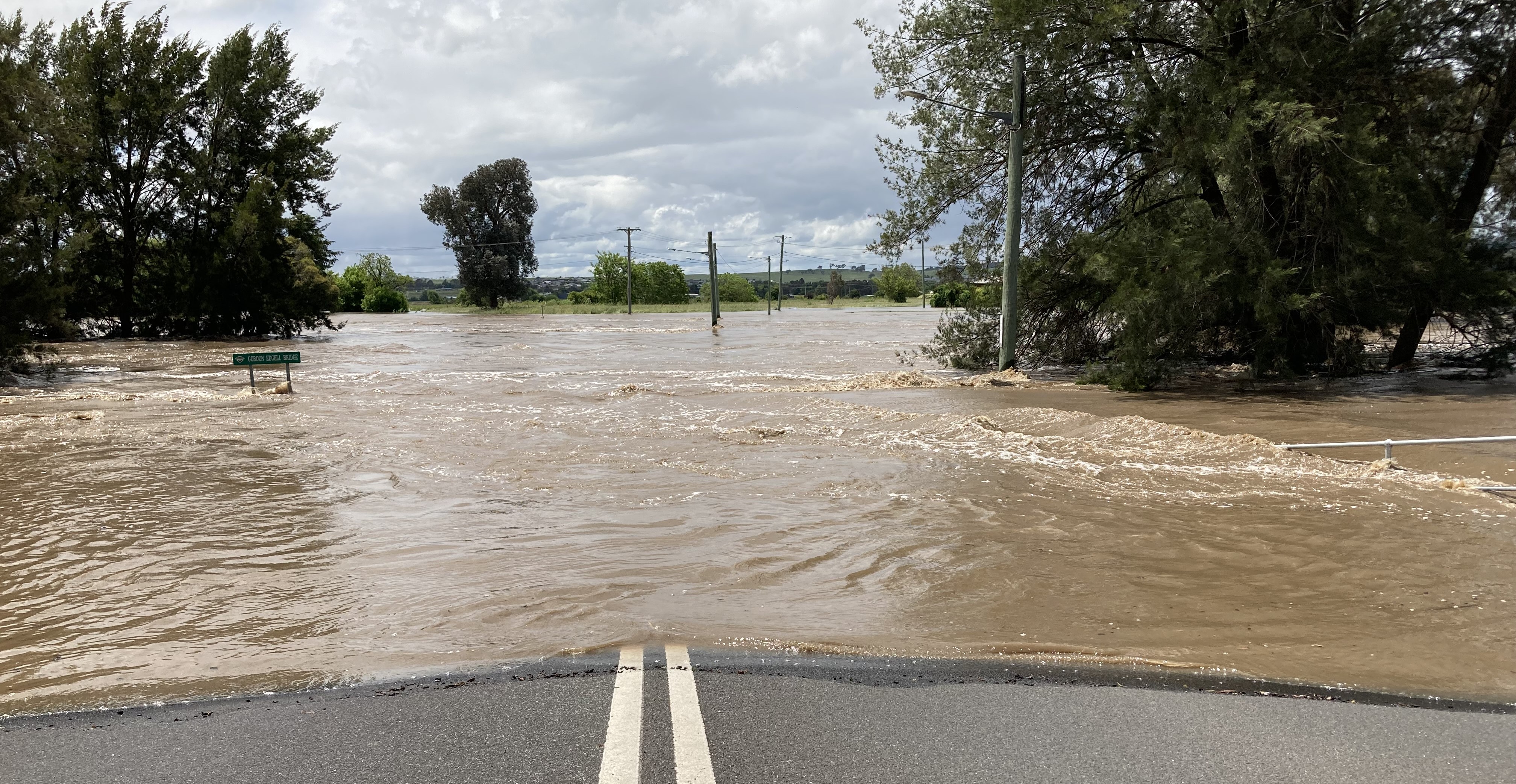
Council’s technical consultant, Stantec, have provided a pre-recorded presentation on the flood study’s project background and the progress to-date, including key project outcomes. Residents are strongly encouraged to watch the video presentation prior to requesting RSVP for one-on-one sessions.
 Submission summary for flood study public exhibition.pdf (257 KB) (pdf)
 Past Projects Relevant to Bathurst Flood Study Update
Thank you for your contribution!
Help us reach out to more people in the community
Share this with family and friends