Figures Maps & Aerials

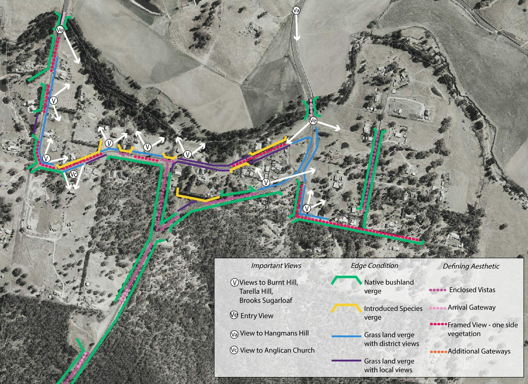
The village is surrounded by Land Zoned RU1 – Primary Production. It is proposed to change the homes on the eastern frontage of Church street from RU1 – Primary Production to RU5 – Village (Pink). A rezoning of these lands, incorporating appropriate buffers to the adjoining rural lands and to Clear Creek, may enable possibly future resubdivision where on-site water and sewer can be accommodated on new allotments. The Orange area is Zone E2 - Environmental Conservation.