Figures Maps & Aerials

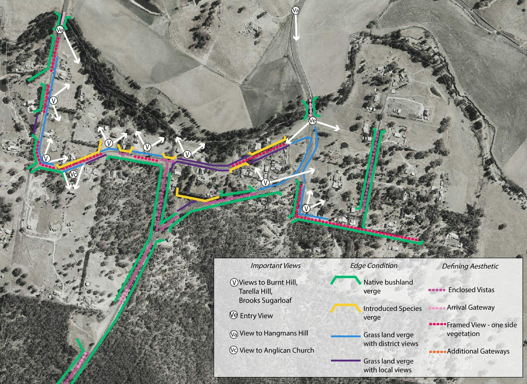
As it is proposed to change the homes on the eastern frontage of Church Street from RU1 – Primary Production to RU5 – Village. This change needs to be reflected on the DCP map. The Agricultural Interface area currently along Church Street will be relocated to the edge of these new portions. A small portion of land to the east of Sofala road is zoned RU5 but is not currently within the village map, this will be added. The shown Enviornmental Protection Areas will apply to these areas.
The single storey restriction in yellow will be removed allowing for double storey throughout the village. Also a portion of land currently zoned E2 Environmental Protection but shown in the village map will be removed.