Bathurst Flood Study update - Study area
The City of Bathurst is subject to mainstream flooding from the Macquarie Wambuul River and its tributaries.
The Bathurst Flood Study Update will consider:
- approximately 29 km of the Macquarie Wambuul River, from the confluence between Fish and Campbells Rivers to the boundary between the localities of Dunkeld and Rock Forest; and
- the local tributaries of Jordan Creek, Raglan Creek, Saltram Creek, Hawthornden Creek, Sawpit Creek and Queen Charlottes Vale Creek.
An indicative map of the Study area is provided in Figure 1.
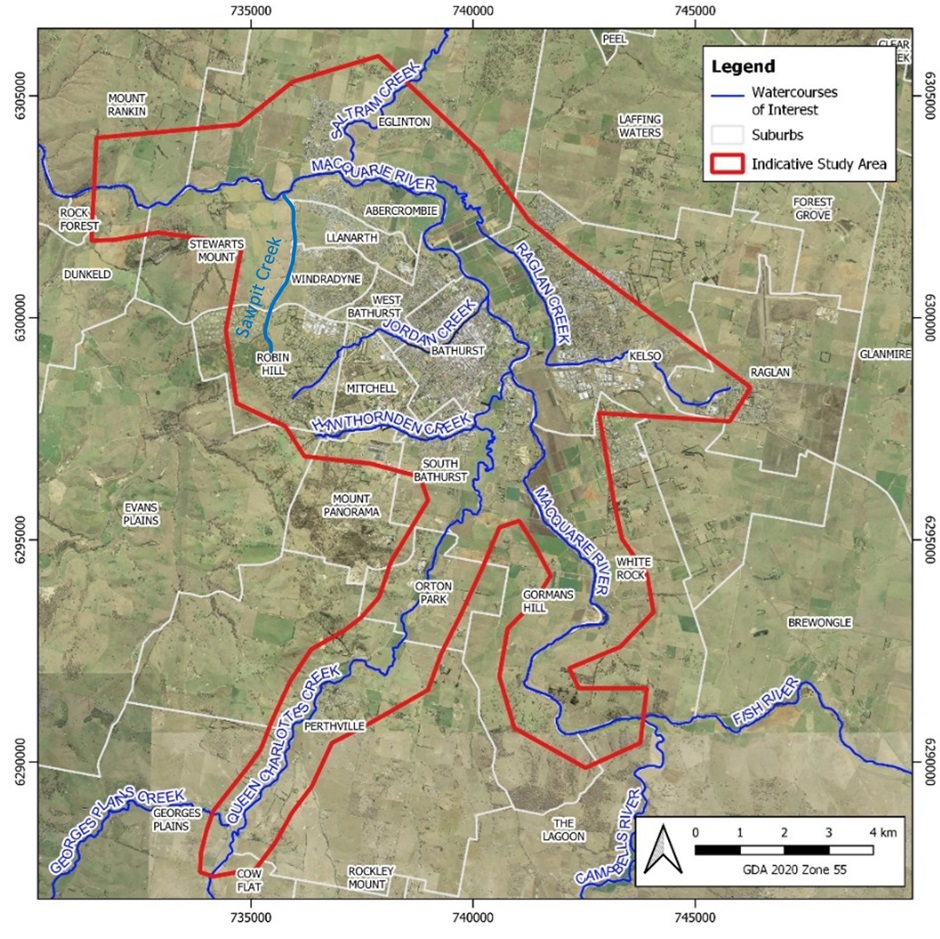 Figure 1: Study Area for the Bathurst Flood Study Update
Share Bathurst Flood Study update - Study area on Facebook
Share Bathurst Flood Study update - Study area on X (formerly Twitter)
Share Bathurst Flood Study update - Study area on Linkedin
Email Bathurst Flood Study update - Study area link

Thank you for your contribution!
Help us reach out to more people in the community
Share this with family and friends